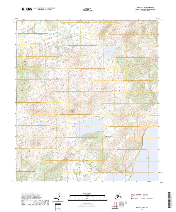
2023 Map of Denali D-5 NW
USGS Topo · Published 2023About this map
Lake Minchumina dominates the southern landscape of this interior Alaska survey, where the water's edge meets the infrastructure of a remote wilderness hub. The presence of the Minchumina Airport and the Landfill Access Road indicates the area's role as a vital supply and transit point for the surrounding region. The terrain is defined by a series of distinct basins and water bodies, including Jim Lake to the north of the main lake and Williams Lake tucked into the higher elevations. This map illustrates the intersection of natural drainage systems like Parker Creek with the essential landing strips that connect these isolated northern communities to the rest of the state.
Find a feature on this map
13 named features on this map. Tap any name to fly to it.
Don’t see what you’re looking for? This feature index may not catch every label — zoom into the map to look around manually.
Map Details
Editions of this 2023 Denali D-5 NW Map
This is the sole edition of this map. No revisions or reprints were ever made.
Other maps of this area

1948 · Kantishna River
USGS Topo · 1:250,000

1951 · Kantishna River
USGS Topo · 1:250,000

1952 · Mount McKinley
USGS Topo · 1:250,000

1952 · Kantishna River
USGS Topo · 1:250,000

1952 · Kantishna River A-5
USGS Topo · 1:63,360

1952 · Kantishna River A-6
USGS Topo · 1:63,360

1953 · Mount McKinley D-5
USGS Topo · 1:63,360
1953 · Kantishna River A-6
USGS Topo · 1:63,360

1954 · Mount McKinley D-5
USGS Topo · 1:63,360

1958 · Mount McKinley D-6
USGS Topo · 1:63,360