
1958 Map of Mount McKinley D-6
USGS Topo · Published 1965About this map
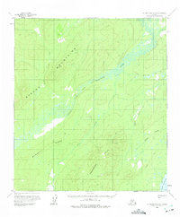
The North Fork Kuskokwim River meanders across this interior Alaskan landscape, characterized by complex oxbow lakes and vast wetlands. Surveyed in the late 1950s, the map reveals a remote wilderness where travel was dictated by seasonal conditions, evidenced by the presence of a Winter Trail cutting through the northern reaches. A solitary Cabin stands as the only marked structure in the entire quadrangle, highlighting the extreme isolation of this region. The terrain is defined by the significant elevations of Munsatli Ridge in the southwest and the Snohomish Hills to the south. Water dominates the environment, from the winding course of Fish Creek to the southern waters of Lake Snohomish, illustrating the intricate drainage patterns of the Kuskokwim basin before modern development or intensive human footprint arrived.
Find a feature on this map
14 named features on this map. Tap any name to fly to it.
Don’t see what you’re looking for? This feature index may not catch every label — zoom into the map to look around manually.
Map Details
Editions of this 1958 Mount McKinley D-6 Map
2 editions found
Other maps of this area

1948 · Kantishna River
USGS Topo · 1:250,000

1950 · Medfra
USGS Topo · 1:250,000

1951 · Kantishna River
USGS Topo · 1:250,000

1951 · Ruby
USGS Topo · 1:250,000

1952 · Mount McKinley
USGS Topo · 1:250,000

1952 · Ruby A-1
USGS Topo · 1:63,360

1952 · Kantishna River
USGS Topo · 1:250,000

1952 · Kantishna River A-5
USGS Topo · 1:63,360

1952 · Kantishna River A-6
USGS Topo · 1:63,360

1952 · Ruby
USGS Topo · 1:250,000