
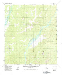
1952 Map of Ruby A-1
USGS Topo · Published 1957About this map
The Sethkokna River meanders sharply through the central portion of this quadrangle, its intricate oxbows and floodplains contrasting with the surrounding elevated terrain. In this mid-century period, the landscape remained largely defined by its natural water systems and topographic prominence rather than human infrastructure, as the survey notes no roads or trails in this area. To the north, Baker Creek drains the upland slopes, while the southeastern corner is marked by Sischu Creek. The most significant elevation point is identified as VABM 2818 Baker, a triangulation station used during the 1954 mapping effort to establish precise control in this interior Alaska wilderness. This document captures the region just before the era of widespread bush pilot travel and modern navigation transformed access to these remote river basins.
Find a feature on this map
4 named features on this map. Tap any name to fly to it.
Don’t see what you’re looking for? This feature index may not catch every label — zoom into the map to look around manually.
Map Details
Editions of this 1952 Ruby A-1 Map
2 editions found
Other maps of this area

1948 · Kantishna River
USGS Topo · 1:250,000

1950 · Medfra
USGS Topo · 1:250,000

1951 · Kantishna River
USGS Topo · 1:250,000

1951 · Ruby
USGS Topo · 1:250,000

1952 · Mount McKinley
USGS Topo · 1:250,000

1952 · Ruby A-2
USGS Topo · 1:63,360

1952 · Ruby B-1
USGS Topo · 1:63,360

1952 · Ruby B-2
USGS Topo · 1:63,360

1952 · Kantishna River
USGS Topo · 1:250,000

1952 · Kantishna River B-6
USGS Topo · 1:63,360