
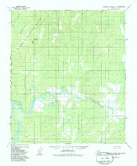
1952 Map of Kantishna River B-6
USGS Topo · Published 1957About this map
The Titna River meanders across this interior Alaskan landscape, defining a complex system of oxbows and marshy lowlands in the central portion of the quadrangle. In the south, the Sethkokna River flows through a similar network of wetlands and small ponds, joined by the headwaters of Baker Creek. This 1952 record, based on aerial photography from the same year, documents a wilderness area defined by significant relief and survey markers including VABM 2341 Lawson and VABM 602 Seth. The lack of established roads or trails during this mid-century period emphasizes the reliance on these waterways for navigation through the dense topographical contours of the Alaska-Fourth Judicial Division.
Find a feature on this map
5 named features on this map. Tap any name to fly to it.
Don’t see what you’re looking for? This feature index may not catch every label — zoom into the map to look around manually.
Map Details
Editions of this 1952 Kantishna River B-6 Map
2 editions found
Other maps of this area

1948 · Kantishna River
USGS Topo · 1:250,000

1951 · Kantishna River
USGS Topo · 1:250,000

1951 · Ruby
USGS Topo · 1:250,000

1952 · Kantishna River C-5
USGS Topo · 1:63,360

1952 · Ruby B-1
USGS Topo · 1:63,360

1952 · Ruby A-1
USGS Topo · 1:63,360

1952 · Ruby C-1
USGS Topo · 1:63,360

1952 · Kantishna River C-6
USGS Topo · 1:63,360

1952 · Kantishna River
USGS Topo · 1:250,000

1952 · Kantishna River A-5
USGS Topo · 1:63,360