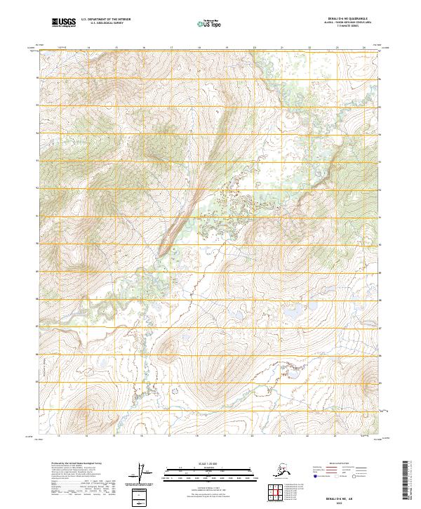
2023 Map of Denali D-6 NE
USGS Topo · Published 2023About this map
The North Fork Kuskokwim River defines the hydrologic character of this interior Alaska landscape, winding through a complex network of wetlands and seasonal watercourses. Elevation rises toward the southwest corner of the sheet, where the prominent Munsatli Ridge overlooks the river valley. The terrain here is typical of the Yukon-Koyukuk region, marked by extensive marshes and numerous small, unnamed ponds that feed into the main river channel and its tributary, Fish Creek. This 2023 survey provides a clear view of the natural drainage patterns and topographical contours that have shaped movement through this wilderness for generations, offering a precise look at the land before further contemporary development or environmental shifts occur in this remote corridor.
Find a feature on this map
12 named features on this map. Tap any name to fly to it.
Don’t see what you’re looking for? This feature index may not catch every label — zoom into the map to look around manually.
Map Details
Editions of this 2023 Denali D-6 NE Map
This is the sole edition of this map. No revisions or reprints were ever made.
Other maps of this area

1948 · Kantishna River
USGS Topo · 1:250,000

1951 · Kantishna River
USGS Topo · 1:250,000

1952 · Mount McKinley
USGS Topo · 1:250,000

1952 · Kantishna River
USGS Topo · 1:250,000

1952 · Kantishna River A-5
USGS Topo · 1:63,360

1952 · Kantishna River A-6
USGS Topo · 1:63,360

1953 · Mount McKinley D-5
USGS Topo · 1:63,360
1953 · Kantishna River A-6
USGS Topo · 1:63,360

1954 · Mount McKinley D-5
USGS Topo · 1:63,360

1958 · Mount McKinley D-6
USGS Topo · 1:63,360