
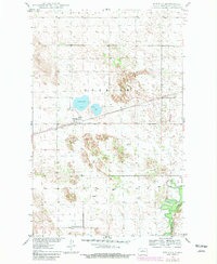
1949 Map of Denbigh
USGS Topo · Published 1977About this map
Denbigh sits at the intersection of the Great Northern railroad and a landscape defined by glacial features in McHenry County. This mid-century survey, compiled from 1948 aerial photography, shows the concentrated settlement around the tracks and the surrounding agricultural expansion into the Denbigh and Wagar townships. The local infrastructure of the era is evidenced by rural education sites like Wintering Sch No 1 and numerous Windmill markers scattered across the plains, indicating a reliance on groundwater for the region's farms.
Find a feature on this map
8 named features on this map. Tap any name to fly to it.
Don’t see what you’re looking for? This feature index may not catch every label — zoom into the map to look around manually.
Map Details
Editions of this 1949 Denbigh Map
2 editions found
Other maps of this area

1949 · Riga
USGS Topo · 1:24,000

1949 · Karlsruhe NW
USGS Topo · 1:24,000

1949 · Bantry
USGS Topo · 1:24,000

1950 · Karlsruhe NE
USGS Topo · 1:24,000

1950 · Towner NW
USGS Topo · 1:24,000

1950 · Towner
USGS Topo · 1:24,000

1950 · Denbigh
USGS Topo · 1:24,000

1950 · Bantry NW
USGS Topo · 1:24,000

1950 · Bantry
USGS Topo · 1:24,000

1954 · Minot
USGS Topo · 1:250,000