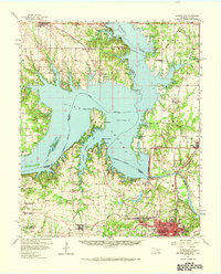
1958 Map of Denison Dam
USGS Topo · Published 1965About this map
Lake Texoma and the Red River valley dominate this late-1950s landscape, illustrating the profound topographical changes following the completion of the Denison Dam. The map captures a transitional era for the border region, where the reservoir has reshaped the local geography, inundating old river bottoms and creating new landmarks like Washita Point and Preston Point. To the south, the city of Denison serves as a major hub, marked by a dense network of the Missouri Kansas and Texas and St Louis and San Francisco railroads. Local genealogy is well-preserved through numerous rural markers, including the Willow Springs Ch and several family burial grounds like the Yarborough Cem. The presence of the Som Springs Oil Field and the Hagerman National Wildlife Refuge reflects the diverse industrial and conservation uses of the land during this period.
Find a feature on this map
68 named features on this map. Tap any name to fly to it.
Don’t see what you’re looking for? This feature index may not catch every label — zoom into the map to look around manually.
Map Details
Editions of this 1958 Denison Dam Map
2 editions found

Other maps of this area

1899 · Atoka
USGS Topo · 1:125,000

1900 · Atoka
USGS Topo · 1:125,000

1901 · Tishomingo
USGS Topo · 1:125,000

1901 · Denison
USGS Topo · 1:125,000

1954 · Sherman
USGS Topo · 1:250,000

1957 · Denison Dam
USGS Topo · 1:24,000

1957 · Ardmore
USGS Topo · 1:250,000

1958 · Durant
USGS Topo · 1:62,500

1958 · Gordonville
USGS Topo · 1:62,500

1958 · Whitesright
USGS Topo · 1:62,500