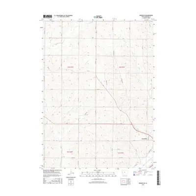
2015 Map of Denison SW
USGS Topo · Published 2015About this map
Denison anchors the southeastern corner of this Crawford County landscape, where the Boyer River valley meets a network of rolling agricultural uplands. The drainage pattern is a defining characteristic of this terrain, with the E Soldier River cutting across the northwest while Buffalo Creek, Bear Creek, and Paradise Creek carve intricate paths through the central sections. This map reveals the established rural infrastructure of the mid-2010s, defined by a rigid section-line road grid including 220th St and M Ave that provides access to the scattered farmsteads of Township 84 North. Modern development on the edge of the county seat is evidenced by Medical Pkwy and the historic route of Lincoln Way, illustrating the evolution of local transportation from early transcontinental highways to contemporary municipal service roads.
Find a feature on this map
40 named features on this map. Tap any name to fly to it.
Don’t see what you’re looking for? This feature index may not catch every label — zoom into the map to look around manually.
Map Details
Editions of this 2015 Denison SW Map
This is the sole edition of this map. No revisions or reprints were ever made.
Other maps of this area

1954 · Omaha
USGS Topo · 1:250,000

1954 · Fort Dodge
USGS Topo · 1:250,000

1957 · Omaha
USGS Topo · 1:250,000

1957 · Fort Dodge
USGS Topo · 1:250,000

1958 · Omaha
USGS Topo · 1:250,000

1958 · Fort Dodge
USGS Topo · 1:250,000

1971 · Ricketts
USGS Topo · 1:24,000

1971 · Schleswig
USGS Topo · 1:24,000

1971 · Earling NE
USGS Topo · 1:24,000

1971 · Denison
USGS Topo · 1:24,000