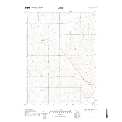
2018 Map of Denison SW
USGS Topo · Published 2018About this map
Denison anchors the southeastern corner of this Crawford County landscape, where the town's modern footprint meets the fertile bottomlands of the Boyer River. The terrain is defined by a dense network of drainage systems, including E Soldier River in the north and the winding paths of Paradise Cr, Willow Cr, and Buffalo Cr. These waterways carve through the agricultural sections of Townships 83, 84, and 85 North, illustrating the classic loess hills topography typical of western Iowa. Historically significant routes like Lincoln Way track alongside the river, while a precise grid of county roads, such as Co HWY e36 and Co HWY m18, provides access to the dispersed farmsteads. The transition from the structured residential streets of the county seat to the expansive rural sections highlights the area's long-standing dependence on its river valleys and soil.
Find a feature on this map
41 named features on this map. Tap any name to fly to it.
Don’t see what you’re looking for? This feature index may not catch every label — zoom into the map to look around manually.
Map Details
Editions of this 2018 Denison SW Map
This is the sole edition of this map. No revisions or reprints were ever made.
Other maps of this area

1954 · Omaha
USGS Topo · 1:250,000

1954 · Fort Dodge
USGS Topo · 1:250,000

1957 · Omaha
USGS Topo · 1:250,000

1957 · Fort Dodge
USGS Topo · 1:250,000

1958 · Omaha
USGS Topo · 1:250,000

1958 · Fort Dodge
USGS Topo · 1:250,000

1971 · Ricketts
USGS Topo · 1:24,000

1971 · Schleswig
USGS Topo · 1:24,000

1971 · Earling NE
USGS Topo · 1:24,000

1971 · Denison
USGS Topo · 1:24,000