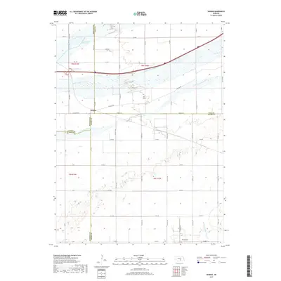
2017 Map of Denman
USGS Topo · Published 2017About this map
The complex braiding of the Platte River defines this portion of central Nebraska, where the waterway splits into the North Channel, Middle Channel, and South Channel. These shifting watercourses create large landmasses like Elm Island, while smaller tributaries such as Dry Cr and the W Br Thirtytwo Mile Cr drain the surrounding agricultural plains. The landscape is structured by a rigid section-line grid of rural roads, including Coal Chute Rd and Barrows Rd, which reflect the region's deep ties to transit and farming.
Find a feature on this map
50 named features on this map. Tap any name to fly to it.
Don’t see what you’re looking for? This feature index may not catch every label — zoom into the map to look around manually.
Map Details
Editions of this 2017 Denman Map
This is the sole edition of this map. No revisions or reprints were ever made.
Other maps of this area

1894 · Kenesaw
USGS Topo · 1:62,500

1894 · Minden
USGS Topo · 1:62,500

1895 · Wood River
USGS Topo · 1:62,500

1896 · Wood River
USGS Topo · 1:125,000

1955 · Grand Island
USGS Topo · 1:250,000

1957 · Grand Island
USGS Topo · 1:250,000

1958 · Grand Island
USGS Topo · 1:250,000

1962 · Denman
USGS Topo · 1:24,000

1962 · Prosser
USGS Topo · 1:24,000
1962 · Gibbon North
USGS Topo · 1:24,000