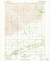
1962 Map of Gibbon North
USGS Topo · Published 1964About this map
Gibbon serves as a focal point for the agricultural plains of Buffalo County, situated where the Union Pacific railroad parallels the meandering Wood River. This 1962 survey captures a rural landscape organized into distinct topographical basins, including Shelton Valley and Gibbon Valley, where a network of section-line roads connects numerous numbered schoolhouses. The presence of School No 86, School No 30, and School No 18 reflects a traditional mid-century rural education structure that was increasingly consolidating at this time.
Find a feature on this map
18 named features on this map. Tap any name to fly to it.
Don’t see what you’re looking for? This feature index may not catch every label — zoom into the map to look around manually.
Map Details
Editions of this 1962 Gibbon North Map
This is the sole edition of this map. No revisions or reprints were ever made.
Other maps of this area

1894 · Kenesaw
USGS Topo · 1:62,500

1894 · Minden
USGS Topo · 1:62,500

1895 · Wood River
USGS Topo · 1:62,500

1896 · Wood River
USGS Topo · 1:125,000

1955 · Grand Island
USGS Topo · 1:250,000

1957 · Grand Island
USGS Topo · 1:250,000

1958 · Grand Island
USGS Topo · 1:250,000

1962 · Denman
USGS Topo · 1:24,000

1962 · Newark
USGS Topo · 1:24,000
1962 · Cameron
USGS Topo · 1:24,000