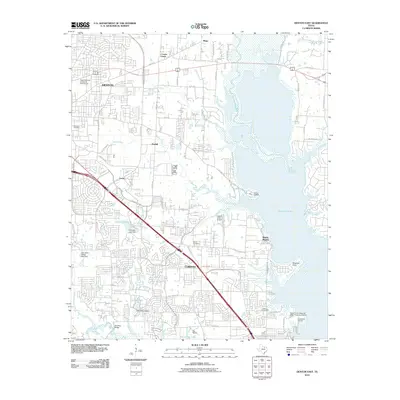
2010 Map of Denton East
USGS Topo · Published 2010About this map
Lewisville Lake dominates the eastern landscape of this North Texas region, where the Elm Fork Trinity River feeds into the reservoir. The map reveals a suburban-rural interface as Denton and Corinth expand toward the water's edge. This 2010 survey documents the complex network of local infrastructure, including the Upper Trinity Regional Water Treatment Facility and several smaller water bodies like Unicorn Lake and Sharon Lake managed by the Galbraith Lake Dam and Lake Sharon Dam.
Find a feature on this map
59 named features on this map. Tap any name to fly to it.
Don’t see what you’re looking for? This feature index may not catch every label — zoom into the map to look around manually.
Map Details
Editions of this 2010 Denton East Map
This is the sole edition of this map. No revisions or reprints were ever made.
Other maps of this area

1925 · Mc Kinney 3-c
USGS Topo · 1:48,000

1929 · Frisco
USGS Topo · 1:62,500

1954 · Sherman
USGS Topo · 1:250,000

1958 · Sherman
USGS Topo · 1:250,000

1960 · Sanger
USGS Topo · 1:24,000

1960 · Green Valley
USGS Topo · 1:24,000
1960 · Argyle
USGS Topo · 1:24,000

1960 · Aubrey
USGS Topo · 1:24,000
1960 · Lewisville East
USGS Topo · 1:24,000
1960 · Lewisville West
USGS Topo · 1:24,000