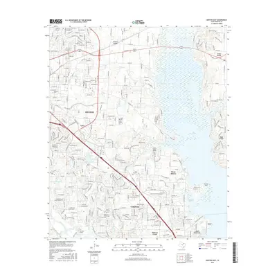
2016 Map of Denton East
USGS Topo · Published 2016About this map
Lake Lewisville dominates the eastern landscape of this North Texas corridor, where the Elm Fork Trinity River feeds into the expansive reservoir. The mapping reveals a densely networked suburban geography anchored by the eastern reaches of Denton and the neighboring municipalities of Corinth, Hickory Creek, and Lake Dallas. This 2016 survey captures the area’s reliance on major transportation arteries like I-35 E and the Lewisville Lake Toll Rd, which facilitate movement between these growing lakefront communities.
Find a feature on this map
33 named features on this map. Tap any name to fly to it.
Don’t see what you’re looking for? This feature index may not catch every label — zoom into the map to look around manually.
Map Details
Editions of this 2016 Denton East Map
This is the sole edition of this map. No revisions or reprints were ever made.
Other maps of this area

1925 · Mc Kinney 3-c
USGS Topo · 1:48,000

1929 · Frisco
USGS Topo · 1:62,500

1954 · Sherman
USGS Topo · 1:250,000

1958 · Sherman
USGS Topo · 1:250,000

1960 · Sanger
USGS Topo · 1:24,000

1960 · Green Valley
USGS Topo · 1:24,000
1960 · Argyle
USGS Topo · 1:24,000

1960 · Aubrey
USGS Topo · 1:24,000
1960 · Lewisville East
USGS Topo · 1:24,000
1960 · Lewisville West
USGS Topo · 1:24,000