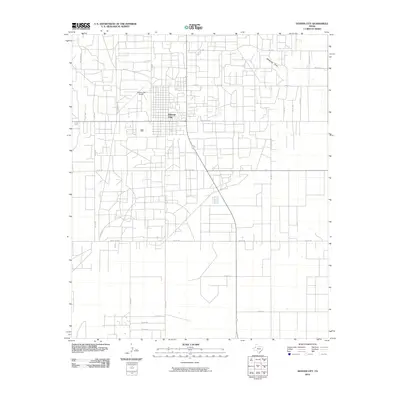
2010 Map of Denver City
USGS Topo · Published 2010About this map
Denver City serves as the central hub of this West Texas landscape, defined by a rigid grid of ranch roads and specialized industrial thoroughfares. The presence of Light Plant Rd and numerous unnamed structures concentrated near the town suggests the region's continued importance to the energy and ranching sectors. Beyond the town limits, the terrain is marked by the natural path of Mckenzie Draw, which cuts across the high plains north of the municipal center. The map reveals a transition between established infrastructure, such as the Denver City Airport, and historical pathways like Chisholm Trl and Wagon Trl on the eastern edge. This network of county roads, including Old Crawford Rd and Ranch Rd 2055, illustrates the systematic development of Yoakum County’s semi-arid environment.
Find a feature on this map
32 named features on this map. Tap any name to fly to it.
Don’t see what you’re looking for? This feature index may not catch every label — zoom into the map to look around manually.
Map Details
Editions of this 2010 Denver City Map
This is the sole edition of this map. No revisions or reprints were ever made.
Other maps of this area

1954 · Hobbs
USGS Topo · 1:250,000

1954 · Brownfield
USGS Topo · 1:250,000

1958 · Brownfield
USGS Topo · 1:250,000

1958 · Hobbs
USGS Topo · 1:250,000

1962 · Brownfield
USGS Topo · 1:250,000

1970 · Seagraves SW
USGS Topo · 1:24,000

1970 · Pleasant Hill
USGS Topo · 1:24,000

1970 · Seagraves NW
USGS Topo · 1:24,000

1971 · Higginbotham
USGS Topo · 1:24,000
1971 · Ink Basin
USGS Topo · 1:24,000