
1970 Map of Pleasant Hill
USGS Topo · Published 1973About this map
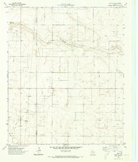
Sulphur Springs Draw meanders across the northern reaches of this High Plains landscape, a terrain defined by the heavy footprint of the Permian Basin's energy economy. The extensive Wasson Field and an adjacent Oil Field dominate the southern half of the quadrangle, where a dense network of Oil Wells and pipelines underscores the region's industrial character. Scattered among these developments are the small community of Sligo and the Pleasant Hill area, which includes a local Cem. The map also captures infrastructure critical to this arid environment, such as a lone Water Tank, and several Gravel Pits that likely supported the construction of the grid-patterned access roads serving the numerous drill sites. This survey provides a precise record of the land before further expansion of twentieth-century secondary recovery techniques changed the surface profile.
Find a feature on this map
11 named features on this map. Tap any name to fly to it.
Don’t see what you’re looking for? This feature index may not catch every label — zoom into the map to look around manually.
Map Details
Editions of this 1970 Pleasant Hill Map
This is the sole edition of this map. No revisions or reprints were ever made.
Other maps of this area

1954 · Hobbs
USGS Topo · 1:250,000

1954 · Brownfield
USGS Topo · 1:250,000

1958 · Brownfield
USGS Topo · 1:250,000

1958 · Hobbs
USGS Topo · 1:250,000

1962 · Brownfield
USGS Topo · 1:250,000

1970 · Seagraves
USGS Topo · 1:24,000

1970 · Tokio
USGS Topo · 1:24,000

1970 · Tokio NW
USGS Topo · 1:24,000
1970 · Tokio SE
USGS Topo · 1:24,000

1970 · Seagraves NW
USGS Topo · 1:24,000