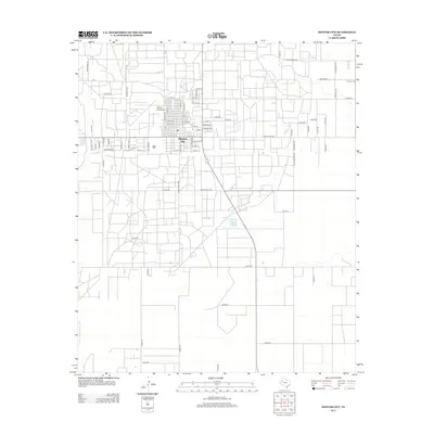
2012 Map of Denver City
USGS Topo · Published 2012About this map
Denver City serves as the focal point of this West Texas landscape, defined by its rigid grid system and the industrial presence of the oil-rich Permian Basin. The map details a transition from the dense residential and commercial core along S Main Ave and Santa Fe Dr to the expansive, road-heavy outskirts. Aviation infrastructure is prominent with the Denver City Airport situated just northwest of the town center, while the surrounding territory is divided by an extensive network of county roads and ranch-to-market routes.
Find a feature on this map
73 named features on this map. Tap any name to fly to it.
Don’t see what you’re looking for? This feature index may not catch every label — zoom into the map to look around manually.
Map Details
Editions of this 2012 Denver City Map
This is the sole edition of this map. No revisions or reprints were ever made.
Other maps of this area

1954 · Hobbs
USGS Topo · 1:250,000

1954 · Brownfield
USGS Topo · 1:250,000

1958 · Brownfield
USGS Topo · 1:250,000

1958 · Hobbs
USGS Topo · 1:250,000

1962 · Brownfield
USGS Topo · 1:250,000

1970 · Seagraves SW
USGS Topo · 1:24,000

1970 · Pleasant Hill
USGS Topo · 1:24,000

1970 · Seagraves NW
USGS Topo · 1:24,000

1971 · Higginbotham
USGS Topo · 1:24,000
1971 · Ink Basin
USGS Topo · 1:24,000