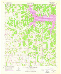
1958 Map of Denver
USGS Topo · Published 1976About this map
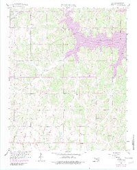
Lake Thunderbird dominates the northern half of this landscape, its expansive waters filling the valley where the Little River and Dave Blue Creek converge. Established between the original 1958 survey and the 1970s photorevisions, the lake's introduction fundamentally altered the drainage of central Cleveland County, surrounding the small settlement of Denver. To the south, the terrain transitions into a patchwork of rural holdings and resource extraction, marked by numerous Oil Wells and Gravel Pits that suggest the local economic drivers of the mid-20th century.
Find a feature on this map
25 named features on this map. Tap any name to fly to it.
Don’t see what you’re looking for? This feature index may not catch every label — zoom into the map to look around manually.
Map Details
Editions of this 1958 Denver Map
5 editions found
Other maps of this area

1892 · Moore
USGS Topo · 1:62,500

1893 · Norman
USGS Topo · 1:62,500

1898 · Purcell
USGS Topo · 1:125,000

1910 · McComb
USGS Topo · 1:62,500

1925 · Norman NO 2
USGS Topo · 1:24,000

1930 · McLoud
USGS Topo · 1:62,500

1934 · Moore
USGS Topo · 1:62,500

1936 · Norman
USGS Topo · 1:62,500

1938 · Moore
USGS Topo · 1:62,500

1954 · Oklahoma City
USGS Topo · 1:250,000