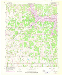
1958 Map of Denver
USGS Topo · Published 1970About this map
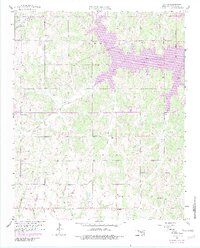
Lake Thunderbird and the Little River dominate this Cleveland County landscape, showing the area as it transitioned with the expansion of Oklahoma City's water infrastructure. The map documents the rural character of the region before significant suburban sprawl, centering on the small settlement of Denver. Local genealogy is well-preserved through numerous landmarks like Liberty Ch, Denver Cem, and the Independence Cem.
Find a feature on this map
26 named features on this map. Tap any name to fly to it.
Don’t see what you’re looking for? This feature index may not catch every label — zoom into the map to look around manually.
Map Details
Editions of this 1958 Denver Map
5 editions found
Other maps of this area

1892 · Moore
USGS Topo · 1:62,500

1893 · Norman
USGS Topo · 1:62,500

1898 · Purcell
USGS Topo · 1:125,000

1910 · McComb
USGS Topo · 1:62,500

1925 · Norman NO 2
USGS Topo · 1:24,000

1930 · McLoud
USGS Topo · 1:62,500

1934 · Moore
USGS Topo · 1:62,500

1936 · Norman
USGS Topo · 1:62,500

1938 · Moore
USGS Topo · 1:62,500

1954 · Oklahoma City
USGS Topo · 1:250,000