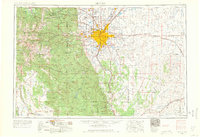
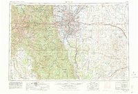
1953 Map of Denver
USGS Topo · Published 1966About this map
Denver sits as the urban hub of the Front Range in this mid-century survey, radiating outward with growing suburbs like Aurora, Arvada, and Englewood. The map captures a transitional era of Western infrastructure, where the heavy rail networks of the Union Pacific and Denver and Rio Grande Western share the landscape with the emerging interstate corridors of I-25 and I-70. To the east, the sprawling Lowry Air Force Base Bombing Range and the Naval Air Station (Buckley Field) underscore the region's significant military footprint during the Cold War. In the high country of the Arapaho National Forest, historic mining centers such as Central City, Black Hawk, and Silver Plume are nestled near the towering summits of Grays Peak and Torreys Peak. This document provides a rare perspective on the Front Range before the full expansion of the reservoir systems and modern mountain development.
Find a feature on this map
170 named features on this map. Tap any name to fly to it.
Don’t see what you’re looking for? This feature index may not catch every label — zoom into the map to look around manually.
Map Details
Editions of this 1953 Denver Map
6 editions found

Other maps of this area

1889 · Leadville
USGS Topo · 1:125,000

1889 · Sanborn
USGS Topo · 1:125,000

1890 · East Denver
USGS Topo · 1:125,000

1891 · Sanborn
USGS Topo · 1:125,000

1891 · Leadville
USGS Topo · 1:125,000

1891 · Limon
USGS Topo · 1:125,000

1892 · Limon
USGS Topo · 1:125,000

1893 · Sanborn
USGS Topo · 1:125,000

1893 · Big Springs
USGS Topo · 1:125,000

1893 · Platte Canyon
USGS Topo · 1:125,000