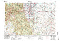
1953 Map of Denver
USGS Topo · Published 1978About this map
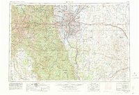
The State Capitol stands at the heart of a rapidly evolving metropolitan landscape, where the high plains meet the Front Range. This study, revised in the late 1970s, captures the post-war expansion of Denver and its satellite communities like Arvada, Englewood, and Westminster. While the urban core densifies, the map preserves the industrial and military presence of the era, notably the Rocky Mountain Arsenal and Lowry Air Force Base. To the west, the terrain rises sharply into the Arapaho National Forest, where historic mining settlements such as Central City and Black Hawk are situated among peaks like Mount Evans. The infrastructure of the period is well-defined, showing the integration of major rail lines like the Denver & Rio Grande Western RR with the emerging interstate system, including Interstate 70 and Interstate 25.
Find a feature on this map
160 named features on this map. Tap any name to fly to it.
Don’t see what you’re looking for? This feature index may not catch every label — zoom into the map to look around manually.
Map Details
Editions of this 1953 Denver Map
6 editions found

Other maps of this area

1889 · Leadville
USGS Topo · 1:125,000

1889 · Sanborn
USGS Topo · 1:125,000

1890 · East Denver
USGS Topo · 1:125,000

1891 · Sanborn
USGS Topo · 1:125,000

1891 · Leadville
USGS Topo · 1:125,000

1891 · Limon
USGS Topo · 1:125,000

1892 · Limon
USGS Topo · 1:125,000

1893 · Sanborn
USGS Topo · 1:125,000

1893 · Big Springs
USGS Topo · 1:125,000

1893 · Platte Canyon
USGS Topo · 1:125,000