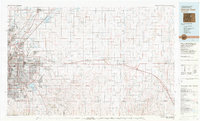
1981 Map of Denver East
USGS Topo · Published 1981About this map
Stapleton International Airport and Buckley Air National Guard Base dominate the transitioning landscape of the eastern plains as they stood in the early 1980s. This survey, produced by the U.S. Geological Survey in cooperation with the Soil Conservation Service, captures the tension between rapid urban expansion and the agricultural heritage of Adams and Arapahoe counties. While the core of Denver and Aurora shows dense development, the eastern reaches remain defined by ephemeral waterways like Box Elder Creek and Kiowa Creek.
Find a feature on this map
103 named features on this map. Tap any name to fly to it.
Don’t see what you’re looking for? This feature index may not catch every label — zoom into the map to look around manually.
Map Details
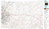
Editions of this 1981 Denver East Map
2 editions found
Other maps of this area

1890 · East Denver
USGS Topo · 1:125,000

1891 · Limon
USGS Topo · 1:125,000

1892 · Limon
USGS Topo · 1:125,000

1893 · Platte Canyon
USGS Topo · 1:125,000

1894 · Castle Rock
USGS Topo · 1:125,000

1899 · West Denver
USGS Topo · 1:125,000

1902 · Greeley
USGS Topo · 1:125,000

1904 · Niwot
USGS Topo · 1:62,500

1913 · Castle Rock
USGS Topo · 1:125,000

1935 · East Denver Nos. 3 and 4
USGS Topo · 1:48,000