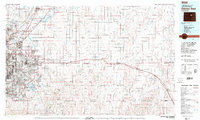
1981 Map of Denver East
USGS Topo · Published 1981About this map
The expanding urban footprint of Denver and Aurora meets the vast high plains in this early 1980s look at the Front Range corridor. Centered on the operational peak of Stapleton International Airport and the sprawling Rocky Mountain Arsenal, the map captures the transition from dense suburban growth to traditional agricultural ranching. The South Platte River valley serves as an industrial artery, supporting communities like Brighton, Henderson, and Commerce City, while the Union Pacific and Burlington Northern railroads follow the historic path of the plains commerce eastward.
Find a feature on this map
69 named features on this map. Tap any name to fly to it.
Don’t see what you’re looking for? This feature index may not catch every label — zoom into the map to look around manually.
Map Details
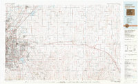
Editions of this 1981 Denver East Map
2 editions found
Other maps of this area

1890 · East Denver
USGS Topo · 1:125,000

1891 · Limon
USGS Topo · 1:125,000

1892 · Limon
USGS Topo · 1:125,000

1893 · Platte Canyon
USGS Topo · 1:125,000

1894 · Castle Rock
USGS Topo · 1:125,000

1899 · West Denver
USGS Topo · 1:125,000

1902 · Greeley
USGS Topo · 1:125,000

1904 · Niwot
USGS Topo · 1:62,500

1913 · Castle Rock
USGS Topo · 1:125,000

1935 · East Denver Nos. 3 and 4
USGS Topo · 1:48,000