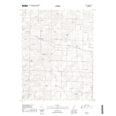
2019 Map of Depauw
USGS Topo · Published 2019About this map
The Blue River winds through the southwestern corner of this Harrison County landscape, defining the topography near the Devils Elbow. The area is characterized by a series of prominent ridges and hills, including Orchard Ridge, Byrd Ridge, and Schoolhouse Hill, which dictate the placement of local thoroughfares like Mount Tabor Rd NW. Small settlements and historic crossroads are distributed across the terrain, with Depauw and Ramsey serving as primary hubs along the east-west corridor.
Find a feature on this map
94 named features on this map. Tap any name to fly to it.
Don’t see what you’re looking for? This feature index may not catch every label — zoom into the map to look around manually.
Map Details
Editions of this 2019 Depauw Map
This is the sole edition of this map. No revisions or reprints were ever made.
Other maps of this area

1931 · Corydon
USGS Topo · 1:62,500

1944 · Corydon West
USGS Topo · 1:24,000

1946 · Leavenworth
USGS Topo · 1:24,000

1946 · Depauw
USGS Topo · 1:24,000

1947 · Leavenworth
USGS Topo · 1:24,000

1947 · Corydon West
USGS Topo · 1:24,000

1947 · Hardinsburg
USGS Topo · 1:24,000

1948 · Corydon East
USGS Topo · 1:24,000

1948 · Milltown
USGS Topo · 1:24,000

1949 · Hardinsburg
USGS Topo · 1:24,000