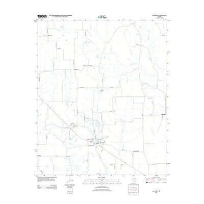
2012 Map of Deport
USGS Topo · Published 2012About this map
The community of Deport serves as the central hub of this Northeast Texas landscape, where a grid of rural routes like Byrdtown Rd and Pattonville Hooverton Rd connects small agricultural settlements and family farmsteads. The topography is defined by a dense network of meandering waterways, including Brushy Cr, Cuthand Cr, and the slow-moving Bee Bayou. Local heritage is preserved in several rural burial grounds such as Wrights Chapel Cem and Bethel Cem, while the town center of Deport exhibits a concentrated street plan near Old City Lake. Further out, smaller locales like Hoover and Byrdtown punctuate the landscape, alongside engineering features like the Soil Conservation Service Site 1 Reservoir, which manages the drainage of the fertile prairie lands between Lake Drain Cr and Mustang Cr.
Find a feature on this map
82 named features on this map. Tap any name to fly to it.
Don’t see what you’re looking for? This feature index may not catch every label — zoom into the map to look around manually.
Map Details
Editions of this 2012 Deport Map
This is the sole edition of this map. No revisions or reprints were ever made.
Other maps of this area

1953 · Texarkana
USGS Topo · 1:250,000

1956 · Texarkana
USGS Topo · 1:250,000

1963 · Minter
USGS Topo · 1:24,000

1963 · Cunningham
USGS Topo · 1:24,000

1964 · Detroit
USGS Topo · 1:24,000

1964 · Deport
USGS Topo · 1:24,000

1964 · Bagwell
USGS Topo · 1:24,000

1964 · Pattonville
USGS Topo · 1:24,000

1964 · Bogata
USGS Topo · 1:24,000

1964 · Blossom
USGS Topo · 1:24,000