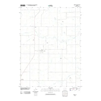
2010 Map of Derby
USGS Topo · Published 2010About this map
Derby serves as the central hub of this rural southern Iowa landscape, where a dense network of local roads and sections meets the winding path of the Chariton River. The town is well-documented for local historians, featuring the Derby Post Office and Derby Cemetery just outside the main residential blocks. The surrounding countryside is notable for its numerous family and community burial grounds, which offer a high level of detail for genealogical research. These include Gay Cemetery in the north, Goshen Cemetery and Webb Cemetery near the river, and Murray Cemetery further south. Waterways like Hamilton Creek, Fivemile Creek, Honey Creek, and Wolf Creek carve through the agricultural parcels, defining the drainage patterns of the region. The road network is clearly labeled with names such as Watrous Ave, Front St, and Co Rd H50, providing a precise reference for the early 21st-century infrastructure of this Lucas County township.
Find a feature on this map
29 named features on this map. Tap any name to fly to it.
Don’t see what you’re looking for? This feature index may not catch every label — zoom into the map to look around manually.
Map Details
Editions of this 2010 Derby Map
This is the sole edition of this map. No revisions or reprints were ever made.
Other maps of this area

1918 · Chariton
USGS Topo · 1:62,500

1934 · Humeston
USGS Topo · 1:48,000

1937 · Corydon
USGS Topo · 1:62,500

1950 · New Virginia
USGS Topo · 1:62,500

1952 · New Virginia
USGS Topo · 1:62,500

1954 · Centerville
USGS Topo · 1:250,000

1954 · Des Moines
USGS Topo · 1:250,000

1956 · Des Moines
USGS Topo · 1:250,000

1957 · Des Moines
USGS Topo · 1:250,000

1957 · Centerville
USGS Topo · 1:250,000