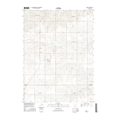
2015 Map of Derby
USGS Topo · Published 2015About this map
The town of Derby serves as the central hub of this agricultural landscape in southern Iowa. Characterized by a dense network of country roads like Vale and Co Rd H50, the area is punctuated by numerous family and community burial grounds, including Goshen Cem, Gay Cem, and Webb Cem. The terrain is defined by the winding course of the Chariton River, which is fed by several tributaries such as Hamilton Cr, Fivemile Cr, and Wolf Cr. The map reveals the precise section lines and township boundaries, including the border between Lucas and Wayne Counties. This detail is particularly useful for genealogists tracing ancestral land tracts near Murray Cem or the southern edge of town near Humeston Cem. The presence of the Po in Derby indicates the town's continued role as a local service point for the surrounding farmsteads.
Find a feature on this map
37 named features on this map. Tap any name to fly to it.
Don’t see what you’re looking for? This feature index may not catch every label — zoom into the map to look around manually.
Map Details
Editions of this 2015 Derby Map
This is the sole edition of this map. No revisions or reprints were ever made.
Other maps of this area

1918 · Chariton
USGS Topo · 1:62,500

1934 · Humeston
USGS Topo · 1:48,000

1937 · Corydon
USGS Topo · 1:62,500

1950 · New Virginia
USGS Topo · 1:62,500

1952 · New Virginia
USGS Topo · 1:62,500

1954 · Centerville
USGS Topo · 1:250,000

1954 · Des Moines
USGS Topo · 1:250,000

1956 · Des Moines
USGS Topo · 1:250,000

1957 · Des Moines
USGS Topo · 1:250,000

1957 · Centerville
USGS Topo · 1:250,000