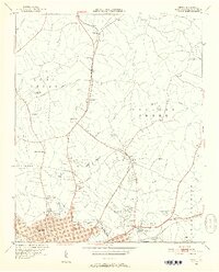
1948 Map of Derita
USGS Topo · Published 1952About this map
Derita and the northern outskirts of Charlotte are captured here just as post-war suburbanization began to reach the rural Mecklenburg landscape. The map reveals a community defined by its water sources and social hubs, from the Derita Mineral Springs to the Southern States Fairgrounds near Sugar Creek Ch. Transport is dominated by the Southern and Seaboard railroads, which influenced the development of small junctions like Atando Junc and settlements like Croft.
Find a feature on this map
63 named features on this map. Tap any name to fly to it.
Don’t see what you’re looking for? This feature index may not catch every label — zoom into the map to look around manually.
Map Details
Editions of this 1948 Derita Map
3 editions found
Other maps of this area

1905 · Charlotte
USGS Topo · 1:48,000

1907 · Charlotte
USGS Topo · 1:62,500

1941 · Charlotte
USGS Topo · 1:125,000

1942 · Charlotte
USGS Topo · 1:125,000

1948 · Paw Creek
USGS Topo · 1:24,000

1948 · Derita
USGS Topo · 1:24,000

1948 · Charlotte East
USGS Topo · 1:24,000

1948 · Charlotte West
USGS Topo · 1:24,000

1949 · Kannapolis
USGS Topo · 1:24,000

1949 · Charlotte West
USGS Topo · 1:24,000