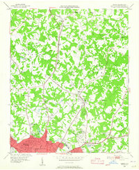
1948 Map of Derita
USGS Topo · Published 1965About this map
Derita and the northern outskirts of Charlotte appear here as a patchwork of small farming communities and emerging industrial sites shortly after the war. The landscape is defined by its transit corridors, where the Southern railroad runs parallel to the Statesville Road, anchoring settlements like Croft and Bethesda. This era captures a distinct local geography including the Derita Mineral Springs and the Southern States Fairgrounds, marking the area as a destination for both recreation and regional commerce.
Find a feature on this map
58 named features on this map. Tap any name to fly to it.
Don’t see what you’re looking for? This feature index may not catch every label — zoom into the map to look around manually.
Map Details
Editions of this 1948 Derita Map
3 editions found
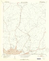
Other maps of this area

1905 · Charlotte
USGS Topo · 1:48,000

1907 · Charlotte
USGS Topo · 1:62,500

1941 · Charlotte
USGS Topo · 1:125,000

1942 · Charlotte
USGS Topo · 1:125,000

1948 · Paw Creek
USGS Topo · 1:24,000

1948 · Derita
USGS Topo · 1:24,000

1948 · Charlotte East
USGS Topo · 1:24,000

1948 · Charlotte West
USGS Topo · 1:24,000

1949 · Kannapolis
USGS Topo · 1:24,000

1949 · Charlotte West
USGS Topo · 1:24,000