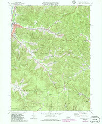
1969 Map of Derrick City
USGS Topo · Published 1986About this map
The Bradford Oil Field dominates the landscape of this 1969 survey, showing a complex network of pipelines and countless well sites threading through the drainages of the Allegheny Plateau. Situated along the New York Pennsylvania border, the area reflects a deeply industrial rural character where small settlements like Derrick City and Gilmore grew alongside the Baltimore and Ohio railroad. The topography is defined by sharp hollows and runs, including Foster Brook and Knapp Creek, which funneled transport and settlement into narrow corridors.
Find a feature on this map
57 named features on this map. Tap any name to fly to it.
Don’t see what you’re looking for? This feature index may not catch every label — zoom into the map to look around manually.
Map Details
Editions of this 1969 Derrick City Map
3 editions found
Other maps of this area

1898 · Olean
USGS Topo · 1:62,500

1900 · Salamanca
USGS Topo · 1:62,500

1924 · Bradford
USGS Topo · 1:62,500

1926 · Bradford
USGS Topo · 1:62,500

1933 · Smethport
USGS Topo · 1:62,500

1937 · Smethport
USGS Topo · 1:62,500

1938 · Salamanca
USGS Topo · 1:62,500

1938 · Olean
USGS Topo · 1:62,500

1941 · Bradford
USGS Topo · 1:62,500

1943 · Olean
USGS Topo · 1:62,500