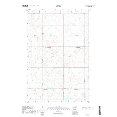
2017 Map of Derrick SE
USGS Topo · Published 2017About this map
Kalhagen Cem, situated near 94th Ave NE, serves as a central landmark for this rural portion of Ramsey County. The landscape is defined by the Public Land Survey System grid, which dictates the placement of local thoroughfares such as Co Hwy 4 and a network of section-line roads ranging from 66th St NE in the north down to 58th St NE at the southern boundary. This 2017 survey illustrates the persistent agricultural and prairie character of the North Dakota interior, where the intersection of north-south avenues like 93rd Ave NE and 97th Ave NE provides the primary infrastructure for the dispersed homesteads and farms of the region. The map captures the subtle drainage patterns and local depressions characteristic of the drift prairie, showing how modern county roads navigate the natural contours of the township lines.
Find a feature on this map
22 named features on this map. Tap any name to fly to it.
Don’t see what you’re looking for? This feature index may not catch every label — zoom into the map to look around manually.
Map Details
Editions of this 2017 Derrick SE Map
This is the sole edition of this map. No revisions or reprints were ever made.
Other maps of this area

1953 · Devils Lake
USGS Topo · 1:250,000

1956 · Devils Lake
USGS Topo · 1:250,000

1971 · Southam
USGS Topo · 1:24,000
1971 · Crary NW
USGS Topo · 1:24,000

1971 · Lakota NW
USGS Topo · 1:24,000

1972 · Derrick NW
USGS Topo · 1:24,000

1972 · Derrick
USGS Topo · 1:24,000

1972 · Derrick SE
USGS Topo · 1:24,000
1972 · Derrick SW
USGS Topo · 1:24,000

1972 · Edmore SW
USGS Topo · 1:24,000