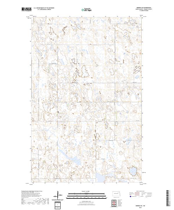
2024 Map of Derrick SE
USGS Topo · Published 2024About this map
Kalhagen Cem stands as a primary historical marker within this rural Ramsey County landscape, situated near the intersection of 62nd St NE and 94th Ave NE. The terrain is defined by a dense network of glacial potholes and wetlands, a characteristic common to the prairie pothole region of North Dakota. This modern survey illustrates a meticulously organized section-line road grid, where routes like Co Hwy 4 and 66th St NE delineate the boundaries of townships such as t156n r62w and t157n r61w. The persistence of the namesake cemetery amidst the surrounding agricultural fields and scattered water bodies provides a specific point of reference for genealogists tracing local family roots in this corner of the state.
Find a feature on this map
23 named features on this map. Tap any name to fly to it.
Don’t see what you’re looking for? This feature index may not catch every label — zoom into the map to look around manually.
Map Details
Editions of this 2024 Derrick SE Map
This is the sole edition of this map. No revisions or reprints were ever made.
Other maps of this area

1953 · Devils Lake
USGS Topo · 1:250,000

1956 · Devils Lake
USGS Topo · 1:250,000

1971 · Southam
USGS Topo · 1:24,000
1971 · Crary NW
USGS Topo · 1:24,000

1971 · Lakota NW
USGS Topo · 1:24,000

1972 · Derrick NW
USGS Topo · 1:24,000

1972 · Derrick
USGS Topo · 1:24,000

1972 · Derrick SE
USGS Topo · 1:24,000
1972 · Derrick SW
USGS Topo · 1:24,000

1972 · Edmore SW
USGS Topo · 1:24,000