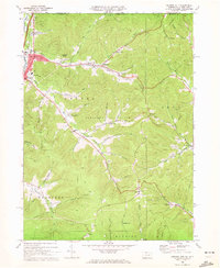
1969 Map of Derricks City
USGS Topo · Published 1972About this map
The Bradford Oil Field dominates this McKean County landscape, characterized by the dense industrial infrastructure required for extraction in the late 1960s. Numerous pipelines crisscross the terrain, following the contours of Buchanan Hollow and Garlock Hollow. The settlement pattern is deeply tied to this geography, with villages like Derrick City, Sawyer City, and Gilmore established along the winding valleys. The northern portion of the map documents the border with New York, where Tuna Creek flows past the Shopping Center and Lincoln School.
Find a feature on this map
66 named features on this map. Tap any name to fly to it.
Don’t see what you’re looking for? This feature index may not catch every label — zoom into the map to look around manually.
Map Details
Editions of this 1969 Derricks City Map
3 editions found
Other maps of this area

1898 · Olean
USGS Topo · 1:62,500

1900 · Salamanca
USGS Topo · 1:62,500

1924 · Bradford
USGS Topo · 1:62,500

1926 · Bradford
USGS Topo · 1:62,500

1933 · Smethport
USGS Topo · 1:62,500

1937 · Smethport
USGS Topo · 1:62,500

1938 · Salamanca
USGS Topo · 1:62,500

1938 · Olean
USGS Topo · 1:62,500

1941 · Bradford
USGS Topo · 1:62,500

1943 · Olean
USGS Topo · 1:62,500