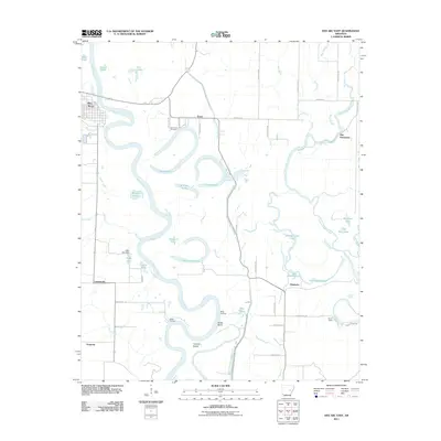
2011 Map of Des Arc East
USGS Topo · Published 2011About this map
The White River winds in dramatic oxbows across this portion of Prairie County, creating a complex landscape of sloughs, eddies, and cutoff lakes. In this 2011 survey, the eastern reaches of Des Arc sit on the high ground of the western bank, while the surrounding lowlands are dotted with small settlements like Erwin, Plunketts, and Letchworth. The area's deep ties to the river are evident in historical points like Weeks Landing and Wilds Landing, which once served as vital connection points between the water and the interior road network.
Find a feature on this map
56 named features on this map. Tap any name to fly to it.
Don’t see what you’re looking for? This feature index may not catch every label — zoom into the map to look around manually.
Map Details
Editions of this 2011 Des Arc East Map
This is the sole edition of this map. No revisions or reprints were ever made.
Other maps of this area

1932 · Kensett
USGS Topo · 1:62,500

1935 · Kensett
USGS Topo · 1:62,500

1935 · Hazen
USGS Topo · 1:62,500

1935 · Gregory
USGS Topo · 1:62,500

1941 · Hazen
USGS Topo · 1:62,500

1941 · De Valls Bluff
USGS Topo · 1:62,500

1948 · Helena
USGS Topo · 1:250,000

1950 · Helena
USGS Topo · 1:250,000

1953 · Memphis
USGS Topo · 1:250,000

1955 · Helena
USGS Topo · 1:250,000