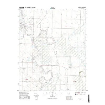
2017 Map of Des Arc East
USGS Topo · Published 2017About this map
The White River carves a serpentine path through this delta landscape, defining the character of eastern Prairie County. Near the bend where Des Arc sits, the river’s oxbow history is visible in a network of water bodies like Horseshoe Lake, Round Lake, and Horn Lake. These features, along with Cypress Swamp and Alligator Lake, illustrate the complex hydrology of the bottomlands. Small rural hubs such as Erwin, Plunketts, and Letchworth serve as anchor points for the surrounding agricultural grid.
Find a feature on this map
58 named features on this map. Tap any name to fly to it.
Don’t see what you’re looking for? This feature index may not catch every label — zoom into the map to look around manually.
Map Details
Editions of this 2017 Des Arc East Map
This is the sole edition of this map. No revisions or reprints were ever made.
Other maps of this area

1932 · Kensett
USGS Topo · 1:62,500

1935 · Kensett
USGS Topo · 1:62,500

1935 · Hazen
USGS Topo · 1:62,500

1935 · Gregory
USGS Topo · 1:62,500

1941 · Hazen
USGS Topo · 1:62,500

1941 · De Valls Bluff
USGS Topo · 1:62,500

1948 · Helena
USGS Topo · 1:250,000

1950 · Helena
USGS Topo · 1:250,000

1953 · Memphis
USGS Topo · 1:250,000

1955 · Helena
USGS Topo · 1:250,000