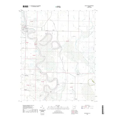
2020 Map of Des Arc East
USGS Topo · Published 2020About this map
Des Arc serves as the focal point of this riverine landscape, where the Prairie County Courthouse stands near the tight bends of the White River. The river dominates the geography, snaking through the center of the quadrangle and creating complex landforms like Wilds Bend and Trimble Island. This environment is characterized by an intricate network of oxbows and backwaters, including Old River Lake, Alligator Lake, and Eddy Lake, which illustrate the shifting course of the waterway over time.
Find a feature on this map
78 named features on this map. Tap any name to fly to it.
Don’t see what you’re looking for? This feature index may not catch every label — zoom into the map to look around manually.
Map Details
Editions of this 2020 Des Arc East Map
This is the sole edition of this map. No revisions or reprints were ever made.
Other maps of this area

1932 · Kensett
USGS Topo · 1:62,500

1935 · Kensett
USGS Topo · 1:62,500

1935 · Hazen
USGS Topo · 1:62,500

1935 · Gregory
USGS Topo · 1:62,500

1941 · Hazen
USGS Topo · 1:62,500

1941 · De Valls Bluff
USGS Topo · 1:62,500

1948 · Helena
USGS Topo · 1:250,000

1950 · Helena
USGS Topo · 1:250,000

1953 · Memphis
USGS Topo · 1:250,000

1955 · Helena
USGS Topo · 1:250,000