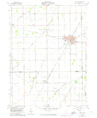
1960 Map of Deshler
USGS Topo · Published 1974About this map
The Baltimore and Ohio Railroad forms a primary industrial axis through this Northwest Ohio landscape, intersecting at the hub of Deshler. The village layout is clearly defined by street names like Mulberry St, Maple St, and Vine St, reflecting a grid system typical of rail-dependent agriculture towns. Outside the village centers, the land is partitioned into large agricultural blocks drained by a network of waterways including Beaver Creek, Hammer Creek, and Brush Creek.
Find a feature on this map
28 named features on this map. Tap any name to fly to it.
Don’t see what you’re looking for? This feature index may not catch every label — zoom into the map to look around manually.
Map Details
Editions of this 1960 Deshler Map
3 editions found
Other maps of this area

1908 · Ottawa
USGS Topo · 1:62,500

1908 · Napoleon
USGS Topo · 1:62,500

1909 · Mc Clure
USGS Topo · 1:62,500

1953 · Fort Wayne
USGS Topo · 1:250,000

1956 · Fort Wayne
USGS Topo · 1:250,000

1956 · Toledo
USGS Topo · 1:250,000

1960 · Deshler
USGS Topo · 1:24,000

1960 · Ottawa
USGS Topo · 1:24,000
1960 · Hamler
USGS Topo · 1:24,000
1960 · Malinta
USGS Topo · 1:24,000