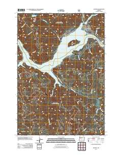
2011 Map of Detroit
USGS Topo · Published 2011About this map
Detroit sits at the confluence of the Breitenbush River and the sprawling waters of Detroit Lake, a central feature of this 2011 topographic survey. The landscape is defined by the significant rise and fall of the terrain around the reservoir, from the heights of Hall Ridge and Kinney Ridge to the steep face of Blowout Cliff. The town itself is small, centered near the Detroit Post Office and Weber St SE, serving as a gateway to the surrounding wilderness.
Find a feature on this map
38 named features on this map. Tap any name to fly to it.
Don’t see what you’re looking for? This feature index may not catch every label — zoom into the map to look around manually.
Map Details
Editions of this 2011 Detroit Map
This is the sole edition of this map. No revisions or reprints were ever made.
Other maps of this area

1929 · Mill City
USGS Topo · 1:125,000

1953 · Salem
USGS Topo · 1:250,000

1954 · Salem
USGS Topo · 1:250,000

1955 · Mill City
USGS Topo · 1:62,500

1956 · Quartzville
USGS Topo · 1:62,500

1956 · Battle Ax
USGS Topo · 1:62,500

1956 · Detroit
USGS Topo · 1:62,500

1960 · Salem
USGS Topo · 1:250,000

1962 · Salem
USGS Topo · 1:250,000

1963 · Salem
USGS Topo · 1:250,000