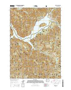
2014 Map of Detroit
USGS Topo · Published 2014About this map
Detroit sits at the northern edge of this 2014 survey, where the N Santiam Hwy meets the waters of Detroit Lake. This landscape is dominated by the steep terrain of the Willamette National Forest, marked by distinctive peaks such as Water Tower Mtn, Piety Knob, and Lucky Butte. The map illustrates the complex drainage network feeding into the lake, including Blowout Cr, Heater Cr, and Tumble Cr.
Find a feature on this map
50 named features on this map. Tap any name to fly to it.
Don’t see what you’re looking for? This feature index may not catch every label — zoom into the map to look around manually.
Map Details
Editions of this 2014 Detroit Map
This is the sole edition of this map. No revisions or reprints were ever made.
Other maps of this area

1929 · Mill City
USGS Topo · 1:125,000

1953 · Salem
USGS Topo · 1:250,000

1954 · Salem
USGS Topo · 1:250,000

1955 · Mill City
USGS Topo · 1:62,500

1956 · Quartzville
USGS Topo · 1:62,500

1956 · Battle Ax
USGS Topo · 1:62,500

1956 · Detroit
USGS Topo · 1:62,500

1960 · Salem
USGS Topo · 1:250,000

1962 · Salem
USGS Topo · 1:250,000

1963 · Salem
USGS Topo · 1:250,000