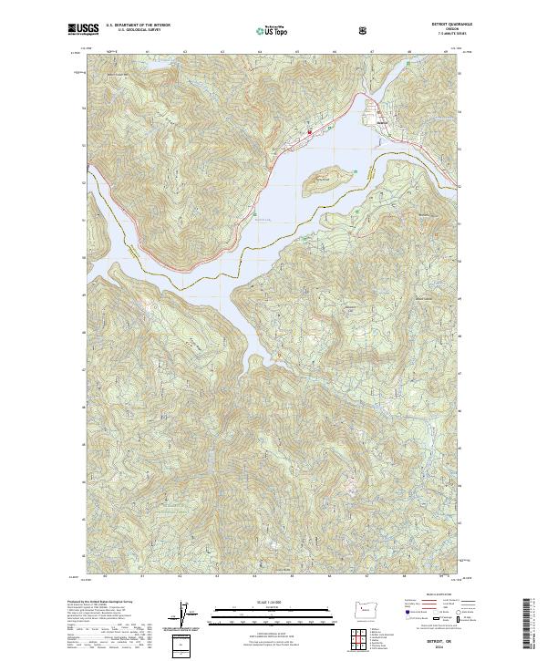
2024 Map of Detroit
USGS Topo · Published 2024About this map
The town of Detroit sits at the northeastern edge of Detroit Lake, a large reservoir created by the damming of the North Santiam River system. This 2024 survey captures the landscape within the Willamette National Forest, where steep ridges and deep drainages define the transition from high peaks to the water’s edge. Significant elevations like Water Tower Mtn, Piety Knob, and Lucky Butte ring the lake, while recreational access is highlighted by the Stahlman Point Trl and Piety Trl.
Find a feature on this map
44 named features on this map. Tap any name to fly to it.
Don’t see what you’re looking for? This feature index may not catch every label — zoom into the map to look around manually.
Map Details
Editions of this 2024 Detroit Map
This is the sole edition of this map. No revisions or reprints were ever made.
Other maps of this area

1929 · Mill City
USGS Topo · 1:125,000

1953 · Salem
USGS Topo · 1:250,000

1954 · Salem
USGS Topo · 1:250,000

1955 · Mill City
USGS Topo · 1:62,500

1956 · Quartzville
USGS Topo · 1:62,500

1956 · Battle Ax
USGS Topo · 1:62,500

1956 · Detroit
USGS Topo · 1:62,500

1960 · Salem
USGS Topo · 1:250,000

1962 · Salem
USGS Topo · 1:250,000

1963 · Salem
USGS Topo · 1:250,000