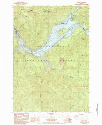
1985 Map of Detroit
USGS Topo · Published 1985About this map
Detroit Lake serves as the central focal point for this mid-1980s topographical study, where the waters of the North Santiam River and Breitenbush River converge. The settlement of Detroit sits on the northern shore, adjacent to numerous recreational sites like Detroit Lake State Park and the Piety Island Campground. This era shows a landscape heavily managed for both timber and recreation, with the Santiam State Forest and Willamette National Forest bordering the reservoir. High peaks and ridges define the drainage basins, including Stahlman Point and Water Tower Mtn. The presence of the Detroit Dam at the western edge of the lake illustrates the massive engineering required to manage these river systems, while remote features like Tumble Lake and Blowout Cliff hint at the wilderness areas surrounding the developed shoreline.
Find a feature on this map
46 named features on this map. Tap any name to fly to it.
Don’t see what you’re looking for? This feature index may not catch every label — zoom into the map to look around manually.
Map Details
Editions of this 1985 Detroit Map
This is the sole edition of this map. No revisions or reprints were ever made.
Other maps of this area

1929 · Mill City
USGS Topo · 1:125,000

1953 · Salem
USGS Topo · 1:250,000

1954 · Salem
USGS Topo · 1:250,000

1955 · Mill City
USGS Topo · 1:62,500

1956 · Quartzville
USGS Topo · 1:62,500

1956 · Battle Ax
USGS Topo · 1:62,500

1956 · Detroit
USGS Topo · 1:62,500

1960 · Salem
USGS Topo · 1:250,000

1962 · Salem
USGS Topo · 1:250,000

1963 · Salem
USGS Topo · 1:250,000