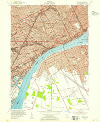
1952 Map of Detroit
USGS Topo · Published 1954About this map
The Detroit River serves as the central artery for this mid-century international border map, showing the dense industrial and urban connection between Detroit and Windsor. The landscape is dominated by heavy infrastructure, including the Ambassador Bridge and the Detroit-Windsor Tunnel, which facilitated the movement of people and goods between the United States and Canada. On the American side, the map details a grid of neighborhoods featuring numerous institutions like Wayne University and Cass High Sch, alongside vast religious and civic landmarks such as St Hedwig Sch and the Mt Elliott Cemetery. To the southwest, the industrial character of the era is evident at Zug Island, located at the confluence of the Rouge River and the Short Cut Canal. Across the water, the growing city of Windsor and its surrounding Sandwich West township reflect the Canadian side of this vital cross-border metropolitan region.
Find a feature on this map
61 named features on this map. Tap any name to fly to it.
Don’t see what you’re looking for? This feature index may not catch every label — zoom into the map to look around manually.
Map Details
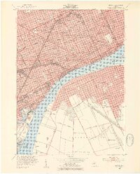
Editions of this 1952 Detroit Map
2 editions found
Other maps of this area

1905 · Detroit
USGS Topo · 1:62,500

1905 · Grosse Pointe
USGS Topo · 1:62,500

1906 · Wyandotte
USGS Topo · 1:62,500

1912 · Wyandotte
USGS Topo · 1:62,500

1918 · Detroit
USGS Topo · 1:62,500

1918 · Grosse Pointe
USGS Topo · 1:62,500

1924 · Detroit
USGS Topo · 1:62,500

1929 · Wyandotte
USGS Topo · 1:62,500

1934 · Detroit
USGS Topo · 1:62,500

1936 · Wyandotte
USGS Topo · 1:31,680