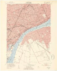
1952 Map of Detroit
USGS Topo · Published 1954About this map
Detroit and Windsor stand as industrial counterparts across the Detroit River in this mid-century survey. The urban landscape of Detroit is dense with neighborhood schools like St Agnes Sch and Sampson Sch, while major institutions such as the Institute of Arts and Ford Hospital anchor the city's civic core. The heavy influence of the automotive and manufacturing era is evident in the sprawling rail infrastructure, including the Michigan Central and Wabash lines, which converge at Union Station. To the south, Zug Island and its Tailings Pond mark the intense industrial activity near the mouth of the Rouge River. On the Canadian side, the street grid of Windsor expands outward from Assumption College, connected to its American neighbor by the monumental Ambassador Bridge and the Detroit-Windsor Tunnel. Landmarks like Briggs Stadium and Belle Isle highlight the city's established recreational spaces during this period of peak urban density.
Find a feature on this map
130 named features on this map. Tap any name to fly to it.
Don’t see what you’re looking for? This feature index may not catch every label — zoom into the map to look around manually.
Map Details
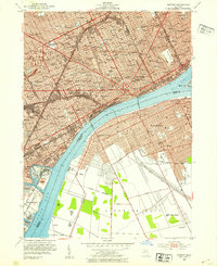
Editions of this 1952 Detroit Map
2 editions found
Other maps of this area

1905 · Detroit
USGS Topo · 1:62,500

1905 · Grosse Pointe
USGS Topo · 1:62,500

1906 · Wyandotte
USGS Topo · 1:62,500

1912 · Wyandotte
USGS Topo · 1:62,500

1918 · Detroit
USGS Topo · 1:62,500

1918 · Grosse Pointe
USGS Topo · 1:62,500

1924 · Detroit
USGS Topo · 1:62,500

1929 · Wyandotte
USGS Topo · 1:62,500

1934 · Detroit
USGS Topo · 1:62,500

1936 · Wyandotte
USGS Topo · 1:31,680