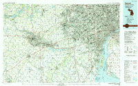
1989 Map of Detroit
USGS Topo · Published 1991About this map
The Detroit River serves as the international artery of this landscape, separating the industrial and urban density of Detroit and its surrounding Michigan suburbs from Windsor, Ontario. At this stage in the late 20th century, the metropolitan area shows a mature network of interstates like I-75 and I-94 connecting the automotive heartland with major educational and institutional anchors such as the University of Michigan in Ann Arbor and Eastern Michigan University in Ypsilanti. The map reveals the immense footprint of the Detroit Metropolitan Wayne Co Airport and the sprawling nature of industrial corridors along the River Rouge.
Find a feature on this map
251 named features on this map. Tap any name to fly to it.
Don’t see what you’re looking for? This feature index may not catch every label — zoom into the map to look around manually.
Map Details
Editions of this 1989 Detroit Map
This is the sole edition of this map. No revisions or reprints were ever made.
Other maps of this area

1902 · South Lyon
USGS Topo · 1:62,500

1902 · Ypsilanti
USGS Topo · 1:62,500

1902 · Dexter
USGS Topo · 1:62,500

1904 · Ann Arbor
USGS Topo · 1:125,000

1905 · Wayne
USGS Topo · 1:62,500

1905 · Detroit
USGS Topo · 1:62,500

1905 · Grosse Pointe
USGS Topo · 1:62,500

1906 · Ypsilanti
USGS Topo · 1:62,500

1906 · Wyandotte
USGS Topo · 1:62,500

1906 · Dexter
USGS Topo · 1:62,500