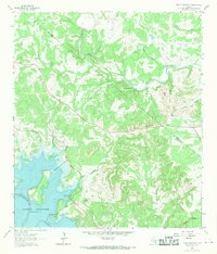
1963 Map of Devils Backbone
USGS Topo · Published 1971About this map
The Devils Backbone ridge dominates this 1963 landscape, marking a prominent topographic divide between the Hays Co Comal Co line. This rugged stretch of the Texas Hill Country is defined by its dramatic limestone drainages, where the Blanco River snakes through the northern reach while the southern portion reveals the rising waters of the Canyon Reservoir along the Guadalupe River. The settlement pattern is sparse and largely rural, centered around ranching and early recreation at places like El Rancho Cima and Eden.
Find a feature on this map
32 named features on this map. Tap any name to fly to it.
Don’t see what you’re looking for? This feature index may not catch every label — zoom into the map to look around manually.
Map Details
Editions of this 1963 Devils Backbone Map
3 editions found
Other maps of this area

1887 · Blanco
USGS Topo · 1:125,000

1894 · Blanco
USGS Topo · 1:125,000

1920 · Smithsons Valley
USGS Topo · 1:62,500

1925 · Hunter No 3
USGS Topo · 1:48,000

1925 · Smithson Valley No. 1
USGS Topo · 1:48,000

1927 · Smithson Valley
USGS Topo · 1:62,500

1929 · Hunter
USGS Topo · 1:62,500

1929 · Smithson Valley
USGS Topo · 1:62,500

1940 · Smithson Valley
USGS Topo · 1:62,500

1954 · Llano
USGS Topo · 1:250,000