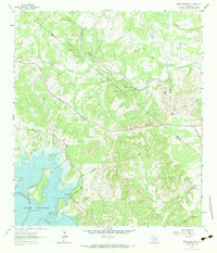
1963 Map of Devils Backbone
USGS Topo · Published 1983About this map
The Devils Backbone ridge dominates this 1963 survey of the Texas Hill Country, following the serpentine boundary between Hays and Comal Counties. This period captures the landscape shortly after the construction of the Canyon Dam, showing the Canyon Reservoir at its normal pool elevation of 909 feet, with boat ramps already established for early recreational use. The terrain is deeply dissected by drainages such as Carpers Creek, Sorrel Creek, and Jacobs Creek, which flow toward the Guadalupe and Blanco rivers.
Find a feature on this map
38 named features on this map. Tap any name to fly to it.
Don’t see what you’re looking for? This feature index may not catch every label — zoom into the map to look around manually.
Map Details
Editions of this 1963 Devils Backbone Map
3 editions found
Other maps of this area

1887 · Blanco
USGS Topo · 1:125,000

1894 · Blanco
USGS Topo · 1:125,000

1920 · Smithsons Valley
USGS Topo · 1:62,500

1925 · Hunter No 3
USGS Topo · 1:48,000

1925 · Smithson Valley No. 1
USGS Topo · 1:48,000

1927 · Smithson Valley
USGS Topo · 1:62,500

1929 · Hunter
USGS Topo · 1:62,500

1929 · Smithson Valley
USGS Topo · 1:62,500

1940 · Smithson Valley
USGS Topo · 1:62,500

1954 · Llano
USGS Topo · 1:250,000