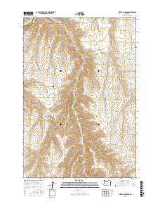
2017 Map of Devils Backbone
USGS Topo · Published 2017About this map
Potters Cem stands as a quiet focal point on the high plateau of the Sherman and Gilliam County line. This arid landscape is defined by the prominent Devils Backbone ridge, which separates the drainage systems of Sixmile Canyon and several ephemeral draws. The network of local roads, such as Esau Rd and Devils Butte Rd, follows the contours of the high country, connecting isolated points of water like Sevenmile Spring and Spring Hollow. The topography reveals the deeply incised nature of the high desert, where Scott Canyon and Corral Hollow carve through the plateau toward Hay Cr. This survey captures a rural Oregon landscape where historic land divisions and remote cemeteries persist amidst the wide-open spaces of the Columbia Basin back-country.
Find a feature on this map
15 named features on this map. Tap any name to fly to it.
Don’t see what you’re looking for? This feature index may not catch every label — zoom into the map to look around manually.
Map Details
Editions of this 2017 Devils Backbone Map
This is the sole edition of this map. No revisions or reprints were ever made.
Other maps of this area

1916 · Arlington
USGS Topo · 1:125,000

1916 · Condon
USGS Topo · 1:125,000

1953 · The Dalles
USGS Topo · 1:250,000

1956 · The Dalles
USGS Topo · 1:250,000

1957 · The Dalles
USGS Topo · 1:250,000

1964 · Turner Butte
USGS Topo · 1:24,000

1964 · Shutler Flat
USGS Topo · 1:24,000

1964 · Mc Donald
USGS Topo · 1:24,000

1970 · Devils Backbone
USGS Topo · 1:24,000

1970 · Igo Butte
USGS Topo · 1:24,000