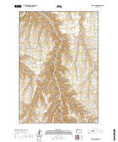
2020 Map of Devils Backbone
USGS Topo · Published 2020About this map
Devils Backbone rises as the central geographic landmark in this high-desert region on the border of Sherman and Gilliam counties. The landscape is defined by its deep, wind-carved drainage systems, including Scott Canyon, Sixmile Canyon, and Spring Hollow. These natural corridors dictate the layout of the sparse road network, where routes like Hay Canyon Rd and Devils Butte Rd follow the contours of the high plateau.
Find a feature on this map
15 named features on this map. Tap any name to fly to it.
Don’t see what you’re looking for? This feature index may not catch every label — zoom into the map to look around manually.
Map Details
Editions of this 2020 Devils Backbone Map
This is the sole edition of this map. No revisions or reprints were ever made.
Other maps of this area

1916 · Arlington
USGS Topo · 1:125,000

1916 · Condon
USGS Topo · 1:125,000

1953 · The Dalles
USGS Topo · 1:250,000

1956 · The Dalles
USGS Topo · 1:250,000

1957 · The Dalles
USGS Topo · 1:250,000

1964 · Turner Butte
USGS Topo · 1:24,000

1964 · Shutler Flat
USGS Topo · 1:24,000

1964 · Mc Donald
USGS Topo · 1:24,000

1970 · Devils Backbone
USGS Topo · 1:24,000

1970 · Igo Butte
USGS Topo · 1:24,000