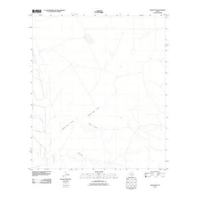
2010 Map of Devils Den
USGS Topo · Published 2010About this map
Devils Den dominates the southern portion of this high desert terrain in Presidio County, where ephemeral drainage patterns define the landscape of the Trans-Pecos. The map shows a complex network of dry washes and canyon systems, most notably the winding path of Robbers Roost Canyon which cuts across the central section before meeting branches of Willow Canyon. These natural corridors provide a detailed look at the topographic relief of the region, characteristic of the remote West Texas ranchlands where water and elevation are the primary features. Along the western edge, the seasonal flow of Alamito Creek carves through the basin, representing a critical geographic marker in an otherwise arid expanse. The sparse road network and lack of formal settlements reflect the enduring character of this isolated territory in the early 21st century.
Find a feature on this map
4 named features on this map. Tap any name to fly to it.
Don’t see what you’re looking for? This feature index may not catch every label — zoom into the map to look around manually.
Map Details
Editions of this 2010 Devils Den Map
This is the sole edition of this map. No revisions or reprints were ever made.
Other maps of this area

1895 · Marfa
USGS Topo · 1:125,000

1895 · Alpine
USGS Topo · 1:125,000

1896 · Shafter
USGS Topo · 1:125,000

1918 · Jordan Gap
USGS Topo · 1:62,500

1930 · Jordan Gap
USGS Topo · 1:62,500

1954 · Fort Stockton
USGS Topo · 1:250,000

1958 · Fort Stockton
USGS Topo · 1:250,000

1959 · Emory Peak
USGS Topo · 1:250,000

1959 · Presidio
USGS Topo · 1:250,000

1959 · Marfa
USGS Topo · 1:250,000