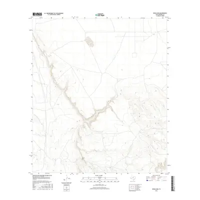
2016 Map of Devils Den
USGS Topo · Published 2016About this map
Devils Den defines the striking topography of this high-desert reach in Presidio County, where the sharp vertical relief of the canyon system dominates the landscape. The drainage patterns of Alamito Cr and Perdiz Cr converge in this arid environment, illustrating the deep erosional channels typical of the Trans-Pecos region. This 2016 survey shows a territory characterized by significant elevation changes and limited human infrastructure, focusing instead on the hydrological arteries that have shaped the land. These watercourses serve as the primary landmarks in an otherwise sparse and open terrain, providing a detailed look at the geomorphology of West Texas.
Find a feature on this map
3 named features on this map. Tap any name to fly to it.
Don’t see what you’re looking for? This feature index may not catch every label — zoom into the map to look around manually.
Map Details
Editions of this 2016 Devils Den Map
This is the sole edition of this map. No revisions or reprints were ever made.
Other maps of this area

1895 · Marfa
USGS Topo · 1:125,000

1895 · Alpine
USGS Topo · 1:125,000

1896 · Shafter
USGS Topo · 1:125,000

1918 · Jordan Gap
USGS Topo · 1:62,500

1930 · Jordan Gap
USGS Topo · 1:62,500

1954 · Fort Stockton
USGS Topo · 1:250,000

1958 · Fort Stockton
USGS Topo · 1:250,000

1959 · Emory Peak
USGS Topo · 1:250,000

1959 · Presidio
USGS Topo · 1:250,000

1959 · Marfa
USGS Topo · 1:250,000