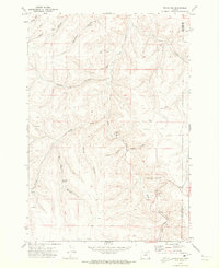
1970 Map of Devils Gap
USGS Topo · Published 1973About this map
Rock Creek and its many ephemeral tributaries carve a complex drainage system through this high plateau country on the border of Gilliam and Morrow counties. The landscape is defined by deep incisions like Cayuse Canyon and Box Elder Canyon, where isolated water sources such as Box Elder Spring and Waterfalls provided essential resources in an otherwise arid environment.
Find a feature on this map
24 named features on this map. Tap any name to fly to it.
Don’t see what you’re looking for? This feature index may not catch every label — zoom into the map to look around manually.
Map Details
Editions of this 1970 Devils Gap Map
This is the sole edition of this map. No revisions or reprints were ever made.
Other maps of this area

1916 · Condon
USGS Topo · 1:125,000

1953 · Pendleton
USGS Topo · 1:250,000

1953 · The Dalles
USGS Topo · 1:250,000

1956 · The Dalles
USGS Topo · 1:250,000

1956 · Pendleton
USGS Topo · 1:250,000

1957 · The Dalles
USGS Topo · 1:250,000

1968 · Gooseberry
USGS Topo · 1:24,000
1968 · Utts Butte
USGS Topo · 1:24,000
1970 · Wolf Hollow Falls
USGS Topo · 1:24,000

1970 · Condon
USGS Topo · 1:24,000